Shira Route: High-Altitude Start
Shira Route
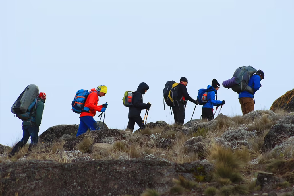
Mount Kilimanjaro, Africa’s highest peak, has multiple routes to its summit, each offering a unique experience. The Shira Route is one of the most scenic but also one of the least used due to its high starting altitude. It begins at Shira Plateau, skipping the rainforest zone, and joins the Lemosho Route on the second day.
If you’re planning to climb Kilimanjaro, this guide will cover:
- Why the Shira Route is a great (but challenging) choice
- A detailed day-by-day itinerary
- The difficulty level and best time to trek
- Essential tips for a successful summit
Why Choose the Shira Route?
The Shira Route is known for its breathtaking views and fast access to high-altitude landscapes.
✅ Scenic and Less Crowded – Offers stunning landscapes similar to the Lemosho Route, but with fewer trekkers.
✅ High Acclimatization Profile – Follows a climb high, sleep low strategy, which helps with altitude adaptation.
✅ Shorter Distance – The route is slightly shorter than Lemosho, making it an appealing option for those who want a scenic trek but with a faster itinerary.
However, there are downsides:
❌ Very High Starting Altitude (3,500m/11,483ft) – This increases the risk of altitude sickness early in the trek.
❌ Misses Rainforest Section – Unlike other routes, the trek starts above the rainforest, skipping the lush jungle experience.
❌ More Difficult Than Lemosho – With a rapid altitude gain, acclimatization can be tough.
Shira Route Itinerary: A Day-by-Day Breakdown
The Shira Route is typically completed in 7 or 8 days. The 8-day itinerary provides better acclimatization and a higher success rate.
Day 1: Shira Gate to Shira 1 Camp
- Elevation: 3,500m to 3,505m (11,483ft to 11,499ft)
- Distance: 5 km (3.1 miles)
- Time: 3-4 hours
Unlike other routes that start at lower altitudes, the Shira Route begins at Shira Gate (3,500m), meaning you drive up a considerable distance before starting your trek. The trail crosses the Shira Plateau, a vast, high-altitude moorland, before reaching Shira 1 Camp.
Day 2: Shira 1 Camp to Shira 2 Camp
- Elevation: 3,505m to 3,850m (11,499ft to 12,631ft)
- Distance: 7 km (4.3 miles)
- Time: 3-4 hours
This is a short but important day for acclimatization. You’ll hike across the plateau, enjoying panoramic views of Kilimanjaro’s peaks. The trail meets up with the Lemosho Route, and you’ll camp at Shira 2 Camp.
Day 3: Shira 2 Camp to Lava Tower (Acclimatization) to Barranco Camp
- Elevation: 3,850m to 4,630m to 3,976m (12,631ft to 15,190ft to 13,044ft)
- Distance: 10 km (6.2 miles)
- Time: 6-7 hours
Today is a crucial acclimatization day. You’ll ascend to Lava Tower (4,630m) before descending to Barranco Camp (3,976m) for the night. This climb high, sleep low approach significantly improves altitude adaptation.
Day 4: Barranco Camp to Karanga Camp
- Elevation: 3,976m to 3,995m (13,044ft to 13,106ft)
- Distance: 5 km (3.1 miles)
- Time: 4-5 hours
The highlight of the day is climbing the Barranco Wall, a steep but non-technical scramble that provides stunning views. The rest of the trek is a mix of valleys and ridges before reaching Karanga Camp.
(Note: If following the 7-day itinerary, trekkers may continue directly to Barafu Camp today.)
Day 5: Karanga Camp to Barafu Camp (Base Camp)
- Elevation: 3,995m to 4,673m (13,106ft to 15,331ft)
- Distance: 4 km (2.5 miles)
- Time: 3-4 hours
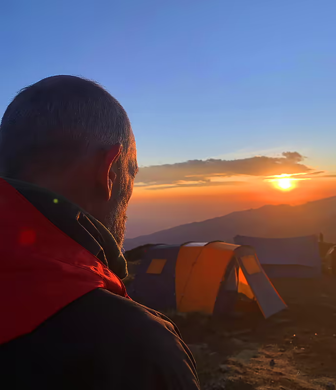
A short but tough hike leads to Barafu Camp, the base camp for your final summit attempt. You’ll rest here for a few hours before beginning your midnight ascent.
Day 6: Barafu Camp to Uhuru Peak (Summit) to Mweka Camp
- Elevation: 4,673m to 5,895m to 3,100m (15,331ft to 19,341ft to 10,170ft)
- Distance: 17 km (10.6 miles)
- Time: 10-14 hours
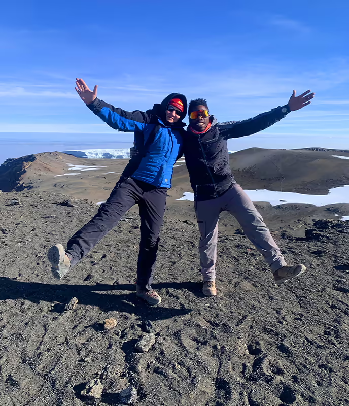
This is summit day! The climb begins at midnight, navigating steep scree and ice fields. You’ll reach Stella Point (5,685m) at sunrise, and after a final push, you’ll stand on Uhuru Peak, the highest point in Africa!
After celebrating, you’ll descend to Mweka Camp for a well-deserved rest.
Day 7: Mweka Camp to Mweka Gate
- Elevation: 3,100m to 1,640m (10,170ft to 5,380ft)
- Distance: 10 km (6.2 miles)
- Time: 3-4 hours
A final descent through the rainforest leads you to Mweka Gate, where you’ll receive your summit certificate before heading back to Moshi.
Your Adventure Awaits – Start Planning Today!
From Tanzania’s wild safaris to the summit of Kilimanjaro and Zanzibar’s serene beaches, your dream getaway begins with a single click.
How Difficult is the Shira Route?
✅ Difficulty Level: Moderate to Challenging, mainly due to the high starting altitude.
✅ Best For: Trekkers who want a scenic route but are comfortable with altitude risks.
✅ Success Rate:
- 7-day trek: ~85%
- 8-day trek: ~90% (Extra acclimatization day improves success rates).
Best Time to Climb Kilimanjaro via Shira Route
☀️ Best Seasons:
- January to March – Fewer crowds, colder nights.
- June to October – Best weather, clear skies, but more trekkers.
🌧️ Avoid:
- April, May, and November – Heavy rains make trails muddy and dangerous.
Essential Tips for a Successful Climb
✔️ Choose the 8-day itinerary – Helps reduce altitude sickness.
✔️ Train for endurance – Strength and cardio training help prepare for summit night.
✔️ Stay hydrated – 3-4 liters of water daily improves altitude adaptation.
✔️ Pack warm gear – Temperatures drop below freezing near the summit.
✔️ Go slow (“Pole Pole”) – A slow pace is crucial for acclimatization.